Automated multi-lane GIS transportation network data generation
- Project
- 18036 SMART
- Type
- New product
- Description
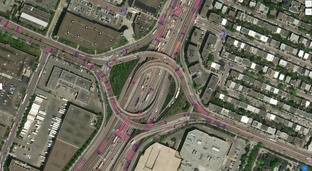
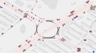
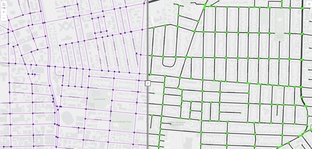
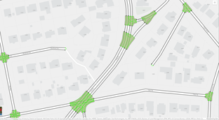
Generate multi-lane, multi-modal GIS transportation network from a traditional link-node road centerline input file. Outputs include conflict zones and intersection topology to provide geographic context for traffic and intersection analytics
- Contact
- Jennifer Overbury or Arif K. Rafiq
- joverbury@esri.ca
- Research area(s)
- Automatic data creation for transportation digital twin, Transportation GIS, traffic and intersection analytics.
- Technical features
Custom scripts within the Esri ArcGIS environment utilizing attributed single road network (municipal or OSM). Output is Esri Feature Class for use within the Esri ecosystem.
- Integration constraints
This is a custom solution that includes necessary components to install within the ArcGIS environment.
- Targeted customer(s)
Road authorities, traffic planners, road safety analysts, GIS departments
- Conditions for reuse
- Sumo
- ArcGIS Pro (Standard License)
- ArcGIS Data Interoperability Extension for Pro (Data Interoperability addon license)
- ArcGIS Roads and Highways (Location Referencing addon License)
- ArcGIS Enterprise
- Python execution environment
- Confidentiality
- Public
- Publication date
- 30-09-2023
- Involved partners
- Esri Canada Limited (CAN)
Images